Why go
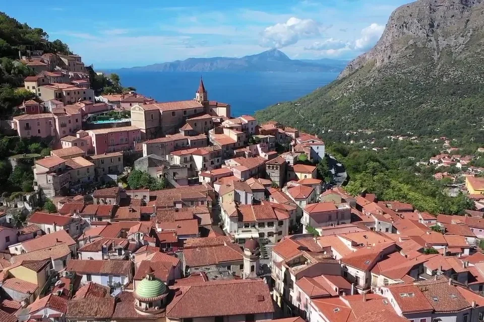
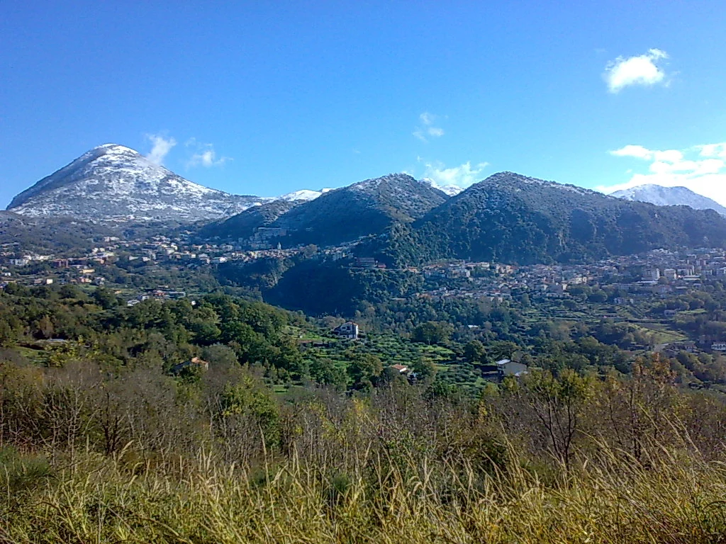
Lauria is the largest and most populous town in the Noce valley, in south-western Basilicata, on the border with Calabria. It stands at a meeting point: here the Noce, Sinni and Mercure valleys converge, and the Mediterranean motorway and the valley roads to the Tyrrhenian and Ionian seas pass through. This position makes it a natural base between the Maratea coast and the Pollino and Sirino mountains.
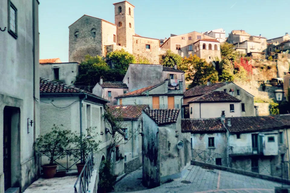
The town is divided into two distinct quarters: Lauria Superiore, called the Castello, with the remains of the fortress linked to Admiral Roger of Lauria, and Lauria Inferiore, the Borgo. In the old centre, its houses clinging to the hill, you walk among lanes, arches and porticoes, stone doorways, coats of arms, decorated cornices and a wealth of wrought-iron railings and gates.
Lauria is also the home of Blessed Domenico Lentini, the town's patron, whose relics are kept in the mother church of San Nicola, a pilgrimage destination all year round, and of Rocco Papaleo, who set part of his film «Scordato» here. From the kitchens, Italy's national tourism portal notes, come the aromas of homemade pasta, grilled meats, cheeses and cured meats.
Sources: Italia.it — Lauria · Comune di Lauria — Territorio e collegamenti · Parco nazionale dell’Appennino Lucano — Lauria · Italy for Movies — Scordato: Lauria, Maratea e Salerno nel film di Papaleo
History
An ancient route runs through Lauria's territory: the Mediterranean motorway roughly follows the Roman road linking Capua with Reggio. In the Middle Ages the town gathered around the castle, built in the 13th century on a rock, possibly with Norman phases suggested by the pointed windows and masonry. The castle bears the name of Roger of Lauria, the famous admiral of the Aragonese fleet.
The town's religious history is written in its churches. The oldest document in the mother church's archive, dated 1522, calls it the first parish church of the land of Lauria; the church of the Borgo, originally dedicated to Saint Matthew, came under the protection of Saint James in the 15th century at the wish of a Spanish countess married to a Sanseverino. In 1617, at the request of the townspeople, the Capuchin convent was founded.
The most dramatic moment came in August 1806, when French troops led by General Masséna sacked and burned the town: much of the church of San Nicola, the sanctuary of the Madonna delle Armi and many documents were destroyed. The churches were rebuilt in the 19th century. The area, of moderate seismic risk, also experienced the earthquake of 9 September 1998.
Sources: Comune di Lauria — Territorio e collegamenti · Comune di Lauria — Castello Ruggiero · Italia.it — Lauria · Comune di Lauria — Chiesa madre di San Nicola · Comune di Lauria — Chiesa di San Giacomo · Comune di Lauria — Convento dei Cappuccini · Comune di Lauria — Santuario della Madonna delle Armi
What to see
In the upper quarter, the mother church of San Nicola, rebuilt after the 1806 fire, has a Latin-cross plan, three stone portals of 1894 and an imposing bell tower; inside are the vault painted by Pasquale Iannotta with Saint Nicholas, the Last Supper and the Madonna and Child, works by Mariano Lanziani and a polychrome marble balustrade of 1616. It keeps the relics of Blessed Domenico Lentini. Higher up stand the ruins of the Ruggiero castle, octagonal in plan with massive walls and traces of towers, open by appointment.
In the Borgo, the three-nave church of San Giacomo holds a precious carved wooden choir, with grotesque figures on the armrests, the oldest part dating from 1554. On the rock overlooking the Noce valley stands the sanctuary of the Madonna delle Armi, with an arched porch and a Romanesque spired bell tower: the name may come from a Greek word for cave, often linked to old Basilian lauras.
Outside the centre, the Capuchin convent, founded on rock in 1617, has a square cloister with a well, the church of Sant'Antonio with a polyptych attributed to Ippolito Borghese and a 17th-century Last Supper in the refectory. Walking between the two quarters you pass palaces with stone doorways, coats of arms and wrought iron.
Sources: Comune di Lauria — Chiesa madre di San Nicola · Italia.it — Lauria · Comune di Lauria — Castello Ruggiero · Comune di Lauria — Chiesa di San Giacomo · Comune di Lauria — Santuario della Madonna delle Armi · Comune di Lauria — Convento dei Cappuccini
Things to do
Part of Lauria's charm is finding the places of cinema. Rocco Papaleo, born here, chose his home town as one of the main locations of «Scordato», the film in which he plays a piano tuner revisiting his life; filming also took in Maratea and Trecchina. Walking through the quarters with the film's images in mind is a different way of looking at the town, but the real discovery is its streets, doorways and wrought iron.
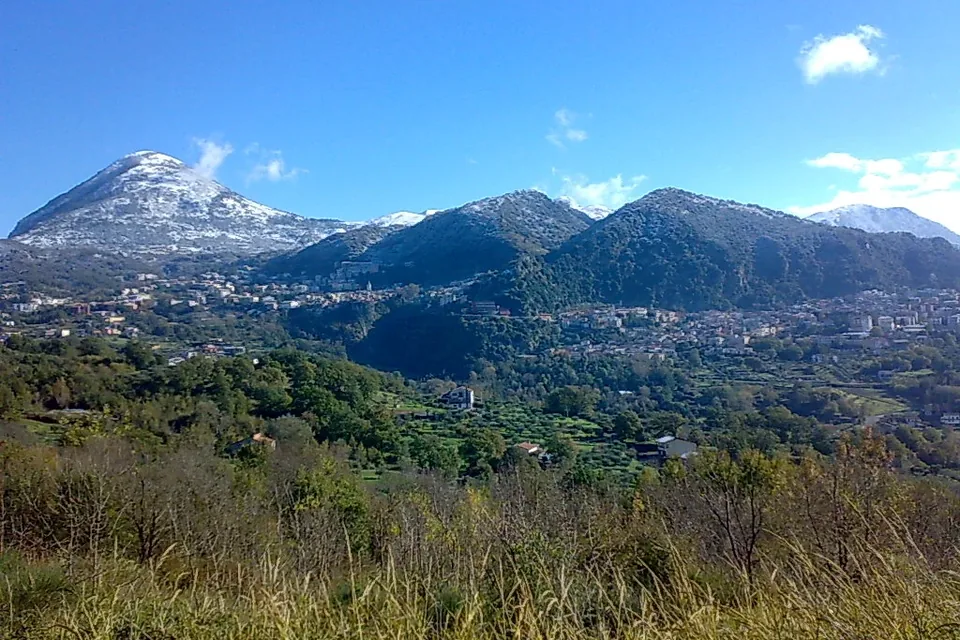
Lauria is also a gateway to the mountains. Part of the municipal area lies in the Appennino Lucano National Park, and the park points to the nearby Conserva area, with ski slopes and equipped areas. The town keeps old crafts such as stone working, wrought iron and wickerwork, with baskets and sieves.
For cyclists, the Pollino park lists the Lagonegro-Rotonda cycle route, running between the Noce and Mercure valleys along the former Calabro-Lucana railway: a slow way to cross the local landscape. The sea at Maratea, with its beaches and Monte San Biagio, is a short distance away.
Sources: Italy for Movies — Scordato: Lauria, Maratea e Salerno nel film di Papaleo · Italia.it — Lauria · Comune di Lauria — Territorio e collegamenti · Parco nazionale dell’Appennino Lucano — Lauria · Parco nazionale del Pollino — Come raggiungerci · Italia.it — Maratea
When to go
Lauria can be visited all year. The mother church of San Nicola, with the relics of Blessed Domenico Lentini, draws pilgrims in every season, and the old centre, with its two quarters, is pleasant to explore at any time.
Spring and autumn are the most pleasant times for walking between the Castello and the Borgo and for heading into the surroundings, towards the Apennine woods or the Noce and Mercure valleys. In summer Lauria is a cool hill base for those alternating the sea at Maratea with trips inland.
In winter, when snow reaches higher ground, the Conserva area mentioned by the park offers ski slopes and equipped areas for snow sports, while the Sirino ski areas are not far away. Dates of religious festivals and town events should be checked each year with the municipality.
Sources: Italia.it — Lauria · Comune di Lauria — Territorio e collegamenti · Parco nazionale dell’Appennino Lucano — Lauria · Parco nazionale dell’Appennino Lucano — Lagonegro · Italia.it — Maratea
Getting there and around
Lauria is a road junction. The municipality notes that the A2 Mediterranean motorway between Salerno and Reggio Calabria, the Sinnica valley road to the Lucanian Ionian coast and the Noce valley road linking the motorway with the Calabrian-Lucanian Tyrrhenian coast all meet here. Both the Pollino park and the Appennino Lucano park list the Lauria exit among the reference exits for entering the protected areas.
By train, the nearest station on the coast is Maratea, on the RFI network, which the Pollino park lists among hubs linked by local buses inland; the park also mentions coach links with Naples, Bari, Rome and other cities, and COTRAB services on the Lucanian side. The reference airports are Naples, Bari and Lamezia Terme.
The town spreads over a slope, with the upper and lower quarters linked by steep streets: the centre is visited on foot, but a car can help for moving between the two quarters and to the Capuchin convent outside the centre.
Sources: Comune di Lauria — Territorio e collegamenti · Parco nazionale del Pollino — Come raggiungerci · Parco nazionale dell’Appennino Lucano — Come arrivare · RFI — Stazione di Maratea · Comune di Lauria — Convento dei Cappuccini
Where to stay
The website of the Appennino Lucano National Park lists accommodation in the protected area's towns, Lauria included, and lets you filter by type: hotels, agriturismi, bed and breakfasts, guest rooms, apartments, holiday houses, hostels and mountain huts. It is a good starting point for finding somewhere that suits your trip.
Those who want to experience the town can look for a place near the old centre, in the Castello or Borgo quarter, so as to walk between churches, squares and trattorias. For a stay closer to nature, countryside agriturismi are handy for the Apennine woods and the Conserva area.
Thanks to its position on the motorway and the valley roads, Lauria also works well as a base for exploring the Maratea coast, Trecchina and the Pollino over several days without changing rooms every night.
Sources: Parco nazionale dell’Appennino Lucano — Dove dormire · Italia.it — Lauria · Parco nazionale dell’Appennino Lucano — Lauria · Comune di Lauria — Territorio e collegamenti
Nearby
Heading down towards the sea you reach Trecchina, at about 500 metres on the slopes of Monte Coccovello, with its piazza del Popolo, Liberty-style palaces built by emigrants to Brazil, the old Castello quarter and the sanctuary of the Madonna del Soccorso; Trecchina also appears among the places of «Scordato».
Further on is Maratea, Basilicata's only town on the Tyrrhenian, with 32 kilometres of coast, an old centre of 44 churches, the basilica of San Biagio and the Redeemer statue on the mountain, with views over the Gulf of Policastro.
Inland, the Appennino Lucano National Park includes Lagonegro, with the glacial Lake Laudemio and the Monte Sirino ski area, and the villages of the Val d'Agri. To the south-east opens the Pollino National Park, reached via the Sinnica or the Mercure valley, with its mountains and Bosnian pines, the protected area's emblem.
Sources: Catalogo generale dei beni culturali (MiC) — Centro storico di Trecchina · Italy for Movies — Scordato: Lauria, Maratea e Salerno nel film di Papaleo · Italia.it — Maratea · Parco nazionale dell’Appennino Lucano — Lagonegro · Parco nazionale del Pollino — Come raggiungerci · Parco nazionale del Pollino — Il pino loricato · Comune di Lauria — Territorio e collegamenti
Where to stay
In the municipality of Lauria the national database of the Ministry of Tourism lists 30 accommodation businesses with a verified CIN code: 3 hotels, 11 other licensed accommodation and 16 other types such as B&Bs and private rentals.
Sources: Ministero del Turismo – Banca Dati Strutture Ricettive (dashboard pubblica), 2026-10-12
YOUR JOURNEY
How to shape a journey here
Memory and cinema between inland places and coast, with visits and guiding arranged for the travel period.
Talk to us about it