Why go
The Cilento covers the southern part of the province of Salerno and is, above all, a national park: the park authority describes it as Italy’s second-largest protected area, reaching from the Tyrrhenian coast up to the Apennine ranges of Campania and Basilicata. Within a few dozen kilometres you move from the marine protected areas of Santa Maria di Castellabate and of the Costa degli Infreschi e della Masseta to the Alburni, Gelbison and Cervati massifs, the last of which is the highest summit in Campania.
The second reason is the sheer depth of history. In 1998 UNESCO added the park to the World Heritage List together with the archaeological sites of Paestum and Velia and the Certosa di Padula, recognising a cultural landscape marked by human presence over an exceptionally long span of time. Italy’s national tourism portal describes olive-covered hills, chestnut and holm-oak woods, streams and villages clinging to rock, with roughly one hundred kilometres of coast made of cliffs, caves and headlands.
For an unhurried traveller the Cilento works best by theme: one day among Greek temples, one on a coastal path, one in the inland villages, one at the table. It is a large territory, and for that very reason it rewards those who choose a few things and look at them slowly.
Sources: Ente Parco Nazionale del Cilento, Vallo di Diano e Alburni — Il Parco Nazionale · UNESCO World Heritage Centre — Cilento and Vallo di Diano National Park with the Archeological Sites of Paestum and Velia, and the Certosa di Padula · Italia.it — Il Cilento, tra spiagge incontaminate, natura selvaggia e borghi accoglienti
History
UNESCO’s summary dates the earliest human traces in the Cilento to around 250,000 years ago. Neolithic farmers, Bronze and Iron Age communities, Etruscans, Greek colonists and Lucanians followed one another until the area became Roman territory in the 3rd century BC. The park notes that the karst landscape, full of caves, sheltered people from the Palaeolithic onwards: ancient tools have been found in the coastal caves between Palinuro and Scario and in inland ones such as Castelcivita and Pertosa-Auletta.
The thread linking these periods is the ridge routes. According to UNESCO, the east–west mountain ridges were for millennia the line of communication between the Adriatic and the Tyrrhenian, abandoned under Rome and revived in the Middle Ages, when castles and religious foundations rose along them. This was also a border land between the colonies of Magna Graecia and the indigenous peoples.
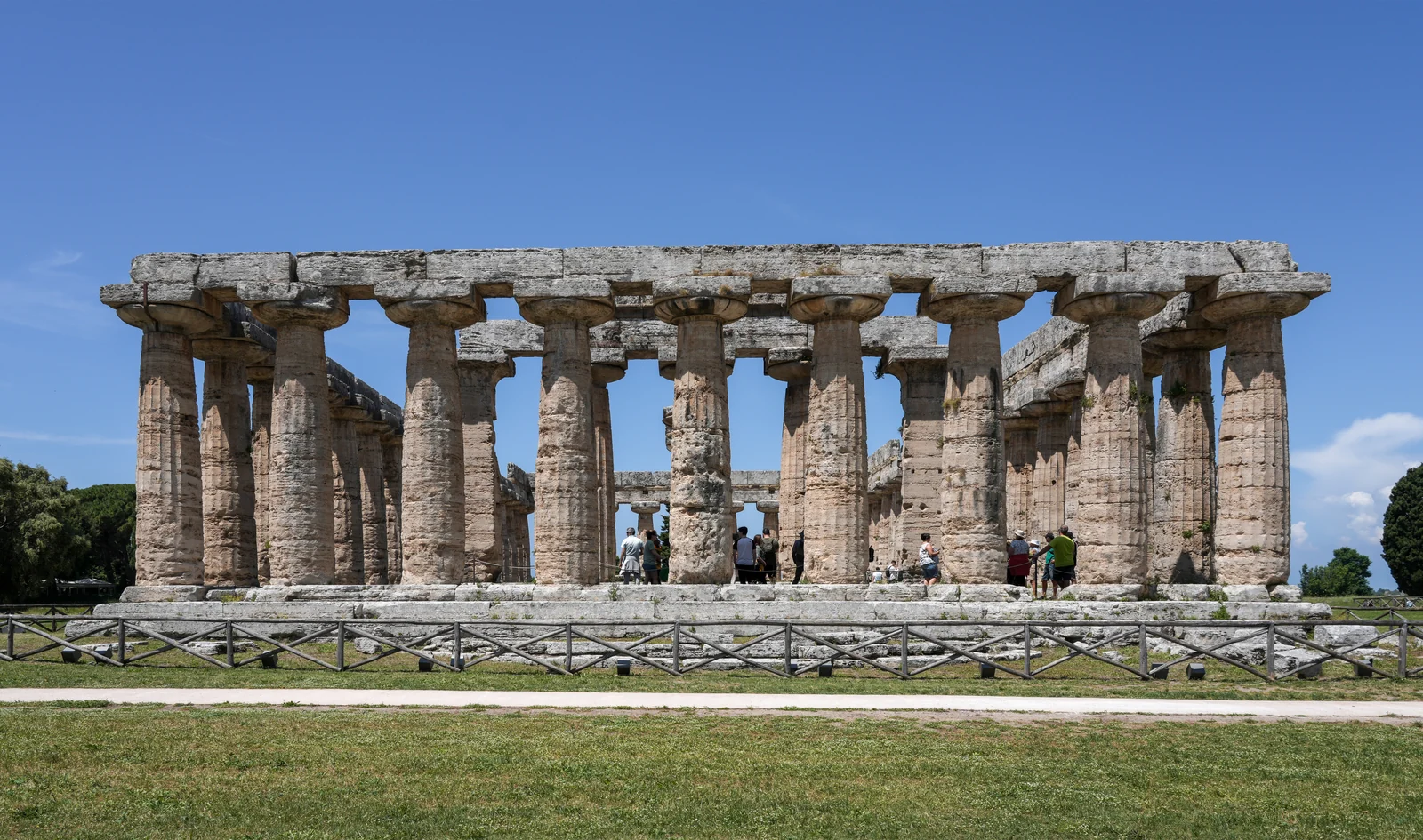
Two Greek cities tell the story of that border. Poseidonia, later Paestum, was founded at the end of the 7th century BC; Elea, today Velia, was founded by the Phocaeans in the second half of the 6th century BC and is tied to the philosophical school of Parmenides and Zeno. Much later, in 1306, building began on the Certosa di San Lorenzo at Padula, whose present Baroque form comes from works carried out in the 17th and 18th centuries.
Sources: UNESCO World Heritage Centre — Cilento and Vallo di Diano National Park with the Archeological Sites of Paestum and Velia, and the Certosa di Padula · Ente Parco Nazionale del Cilento, Vallo di Diano e Alburni — La Storia · Italia.it — Il Cilento, tra spiagge incontaminate, natura selvaggia e borghi accoglienti
What to see
Paestum and Velia now form a single state archaeological park with two sites: the Paestum area at Capaccio Paestum and the Velia area at Ascea Marina. At Paestum the Doric temples and the museum bring back the Greek and then Roman city; at Velia you walk among the remains of the Phocaean colony, up to the acropolis and along routes the park also offers as themed itineraries. They are two different, complementary visits, best given separate days.
In the Vallo di Diano, the Certosa di San Lorenzo at Padula is described by UNESCO as one of the most impressive monastic structures in the world; it also houses the archaeological museum of western Lucania. The national tourism portal calls it the largest monastic complex in southern Italy.
The natural landscape has its own monuments. The Cilento geopark is rich in karst features, sinkholes and caves: the Castelcivita cave runs for almost five kilometres, while at Pertosa-Auletta the Negro river flows through one of the underground branches. Along the coast the Cilento Flysch forms layered, coloured rock, clearly visible at the Ripe Rosse and at Punta Licosa. Italia.it also points to Palinuro, Marina di Camerota, the Capelli di Venere waterfall at Casaletto Spartano, the hill village of Castelnuovo Cilento and the bay of Trentova at Agropoli.
Sources: Ministero della Cultura — Parchi archeologici di Paestum e Velia · UNESCO World Heritage Centre — Cilento and Vallo di Diano National Park with the Archeological Sites of Paestum and Velia, and the Certosa di Padula · Ente Parco Nazionale del Cilento, Vallo di Diano e Alburni — Geologia e geomorfologia · Italia.it — Il Cilento, tra spiagge incontaminate, natura selvaggia e borghi accoglienti
Food and wine
The Cilento holds a special place in the history of food: the park authority recalls that Ancel and Margaret Keys settled in Pollica and studied local ways of living, eventually coining the term “Mediterranean diet”. In 2010 UNESCO inscribed it on the Intangible Cultural Heritage list as a body of practices, knowledge and shared meals handed down in this park among other places. It is a way of sitting at the table before it is a list of foods.
Among the protected-name products are Fico Bianco del Cilento PDO, a dried white fig produced in 68 municipalities from the hills of Agropoli down to the Bussento, and Cilento PDO extra virgin olive oil, made from varieties such as Pisciottana, Rotondella and Salella, from an olive tradition the sources trace back to Magna Graecia. From the plain between Paestum and Eboli comes the Carciofo di Paestum PGI, the round artichoke harvested from February to May.
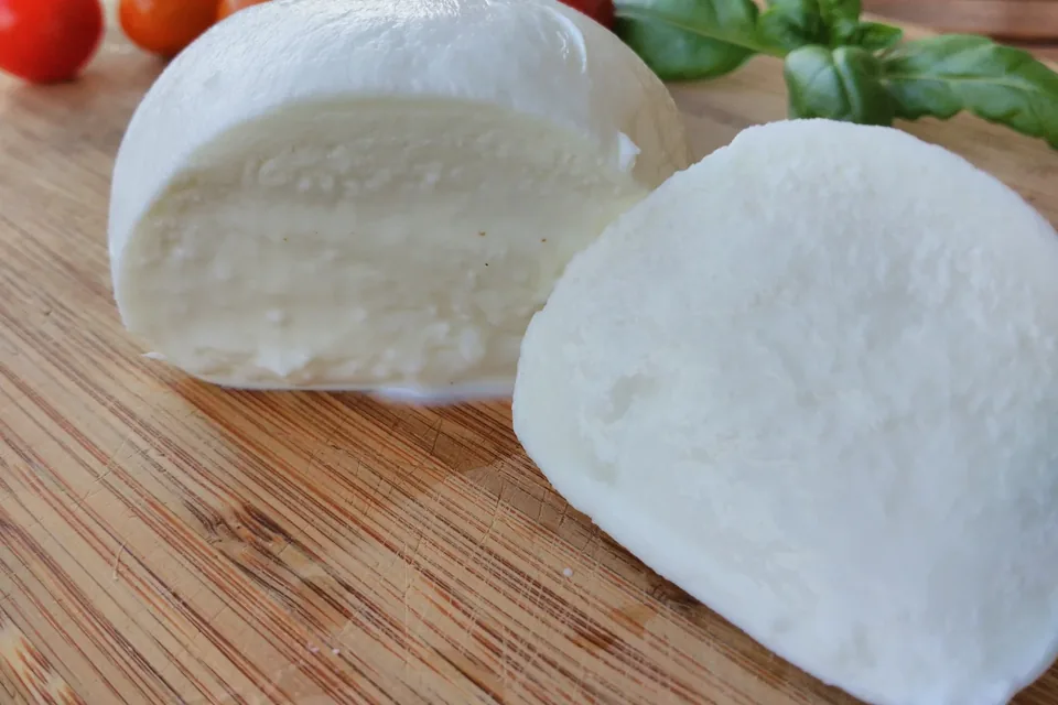
Slow Food presidia tell the smaller stories of the kitchen: menaica anchovies from Pisciotta and Pollica, caught with the traditional net and matured under salt, and Cilento goat’s-milk cacioricotta, eaten fresh or grated over fusilli with meat sauce. Italia.it also mentions buffalo mozzarella from the Capaccio Paestum area, cavateddi, lagane with chickpeas and Felitto fusillo.
Sources: Ente Parco Nazionale del Cilento, Vallo di Diano e Alburni — Dieta mediterranea · Qualigeo (Fondazione Qualivita) — Fico Bianco del Cilento DOP · Qualigeo (Fondazione Qualivita) — Cilento DOP, olio extravergine di oliva · Qualigeo (Fondazione Qualivita) — Carciofo di Paestum IGP · Fondazione Slow Food — Presidio Alici di menaica · Fondazione Slow Food — Presidio Cacioricotta del Cilento · Italia.it — Il Cilento, tra spiagge incontaminate, natura selvaggia e borghi accoglienti
Things to do
The Cilento sea is protected: in 2009 the marine areas of Santa Maria di Castellabate and of the Costa degli Infreschi e della Masseta were established, which the park describes as a few kilometres of coast with inlets, small beaches, underwater springs and karst caves, to be explored by swimming with care. Along the Palinuro headland, Italia.it points to the Sentiero della Primula, about fourteen kilometres with views over the sea, woods and archaeological areas.
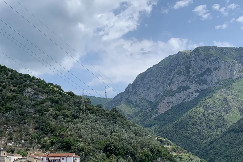
Inland the experience changes. The park distinguishes three broad environments: the Gelbison-Cervati massif with its beech woods, the Alburni with holm oak and scrub on the sunny slopes, and the coastal Cilento, where the Palinuro primrose, symbol of the park, and other endemic species flower on the cliffs. It is also home to wildcat, wolf, golden eagle and, in the rivers, otter and spectacled salamander.
The caves are a chapter of their own: at Pertosa-Auletta one of the three branches holds the visitor route, while Castelcivita, in the Alburni massif, is among the largest cave systems in southern Italy. They explain the karst character that brought the park into the UNESCO geopark network. For a balanced trip, a day on the trails or in the water pairs well with a day of archaeology and an afternoon in an inland village.
Sources: Ente Parco Nazionale del Cilento, Vallo di Diano e Alburni — Aree marine protette · Italia.it — Il Cilento, tra spiagge incontaminate, natura selvaggia e borghi accoglienti · Ente Parco Nazionale del Cilento, Vallo di Diano e Alburni — Biodiversità · Italia.it — Parco Nazionale del Cilento, Vallo di Diano e Alburni · Ente Parco Nazionale del Cilento, Vallo di Diano e Alburni — Geologia e geomorfologia
When to go
Spring, summer and autumn offer three different Cilentos, and the produce calendar helps you choose. In spring the Paestum plain is in artichoke season, with harvest from February to May, and the coastal paths are at their best for walking; menaica anchovies are fished from spring into summer, from March to August, and in Pisciotta they are bought straight from the harbour early in the morning.
Summer is the season for the sea and the marine protected areas, when swimming among coves and caves is most enjoyable; keep the hottest hours for museums and churches, and plan Paestum and Velia in the morning. In August the harvest begins for the figs that will become Fico Bianco del Cilento.
Autumn brings new oil: the Cilento PDO rules require olives to be harvested by 31 December, and milling must take place within two days of picking. It is also the season of chestnut woods and clear days on the ridges, suited to inland hikes. Those who choose winter will still find the territory open to visitors: in that case, check openings and connections in advance.
Sources: Qualigeo (Fondazione Qualivita) — Carciofo di Paestum IGP · Fondazione Slow Food — Presidio Alici di menaica · Ente Parco Nazionale del Cilento, Vallo di Diano e Alburni — Aree marine protette · Ministero della Cultura — Parchi archeologici di Paestum e Velia · Qualigeo (Fondazione Qualivita) — Fico Bianco del Cilento DOP · Qualigeo (Fondazione Qualivita) — Cilento DOP, olio extravergine di oliva · Italia.it — Il Cilento, tra spiagge incontaminate, natura selvaggia e borghi accoglienti
Getting there and around
The train is the simplest way to reach the coast: along the shore the RFI rail network includes, among others, the stations of Paestum, Agropoli-Castellabate, Vallo della Lucania-Castelnuovo, Pisciotta-Palinuro and Sapri: these are the natural gateways to the archaeological park, the central coast and the Gulf of Policastro.
Once there, distances matter. The park covers about 180,000 hectares, all within the province of Salerno, with inland villages often reached by mountain roads. The advice is therefore to choose one base, on the coast or inland, and to move by car or with organised transfers, giving each day to one area rather than crossing the territory end to end.
The archaeological park lists its entrances on Via Magna Grecia in Capaccio Paestum and on Piazzale Amedeo Maiuri in Ascea Marina, in municipalities served by Paestum and the other coastal stations. For the marine protected areas, caves and trails, the park authority, based in Vallo della Lucania, is the place to ask.
Sources: RFI — Stazione di Paestum · RFI — Stazione di Agropoli-Castellabate · RFI — Stazione di Vallo della Lucania-Castelnuovo · RFI — Stazione di Pisciotta-Palinuro · RFI — Stazione di Sapri · Ente Parco Nazionale del Cilento, Vallo di Diano e Alburni — La Storia · Ministero della Cultura — Parchi archeologici di Paestum e Velia · Ente Parco Nazionale del Cilento, Vallo di Diano e Alburni — Sede legale e uffici
Nearby
To the north the Cilento borders the Sele plain, the farmland between Paestum, Capaccio, Eboli and Battipaglia where the Carciofo di Paestum is grown; beyond the plain rise the Picentini Mountains, with beech woods and springs, and, further north along the Gulf of Salerno, the Amalfi Coast. Both combine well with the Cilento for a week or more in Campania.
To the east the park includes the Vallo di Diano, the upland basin where the Certosa di Padula stands. The same area offers the Pertosa-Auletta caves and, on the Alburni, the karst world of the Castelcivita cave. Travellers arriving from this side can spend a day inland before heading down to the sea.
To the south the Cilento faces the Gulf of Policastro, with Sapri as a station on the southern stretch of the coast, and the park reaches the border with Basilicata. UNESCO recalls that these ridges and valleys were for centuries a corridor between two seas, which is also a good way to think about an itinerary: the Cilento as a hinge between the Gulf of Salerno, the Apennines and the Lucanian coast.
Sources: Qualigeo (Fondazione Qualivita) — Carciofo di Paestum IGP · UNESCO World Heritage Centre — Cilento and Vallo di Diano National Park with the Archeological Sites of Paestum and Velia, and the Certosa di Padula · Ente Parco Nazionale del Cilento, Vallo di Diano e Alburni — Geologia e geomorfologia · Italia.it — Il Cilento, tra spiagge incontaminate, natura selvaggia e borghi accoglienti · Italia.it — Parco Nazionale del Cilento, Vallo di Diano e Alburni · RFI — Stazione di Sapri
Local tourist information
Local tourist offices help with opening times, events and transport on the day.
- Ente Parco Nazionale del Cilento, Vallo di Diano e Alburni — Ufficio Relazioni con il pubblico · Palazzo Mainenti, via F. Palumbo 18, 84078 Vallo della Lucania (SA) · +39 0974 7199200 · parco@cilentoediano.it · Official website
Source: Ente Parco Nazionale del Cilento, Vallo di Diano e Alburni — Sede legale e uffici · checked on
Where to stay
In the municipality of Vallo della Lucania the national database of the Ministry of Tourism lists 28 accommodation businesses with a verified CIN code: 1 hotels, 9 other licensed accommodation and 18 other types such as B&Bs and private rentals.
Sources: Ministero del Turismo – Banca Dati Strutture Ricettive (dashboard pubblica), 2026-10-12
YOUR JOURNEY
How to shape a journey here
Four days between Paestum, Velia, a park trail and the Padula Charterhouse, from a single base. Guides and accommodation to be arranged with local operators.
Talk to us about it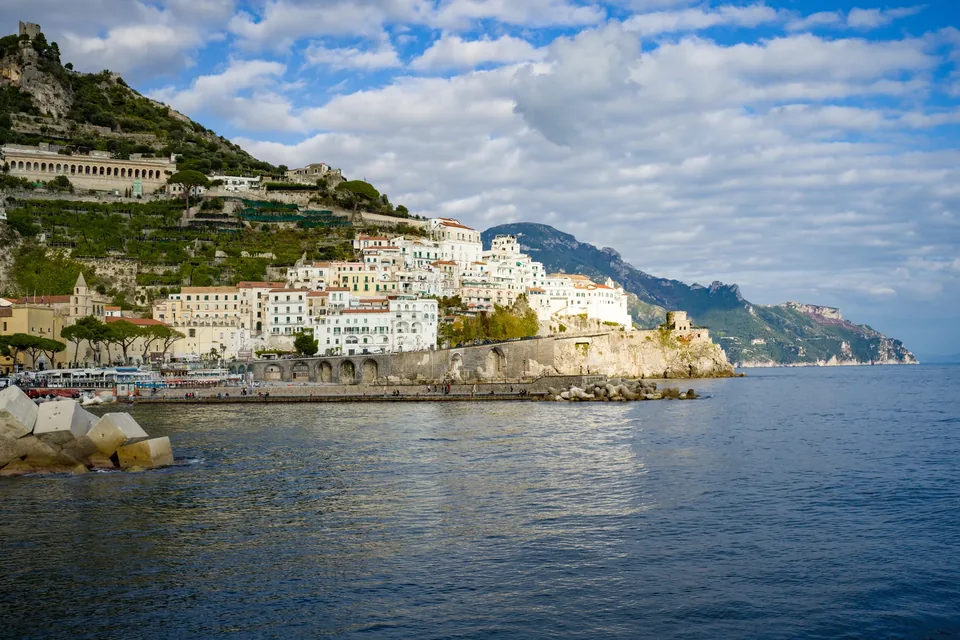
,_East_view.jpg)


