APULICA / WALKS
Cammino del Salento (Salento Way)
Lecce, Porta Napoli → Santa Maria di Leuca, De Finibus Terrae sanctuary · 115 km (Via del Mare). The Via dei Borghi measures 135 km in 6 stages according to both the official site and italia.it, but the official site states it is closed for 2026. · 5 stages on the Via del Mare, each between 20 and 25 km; the Via dei Borghi, closed in 2026, has 6.
Key facts
| Start and finish | Lecce, Porta Napoli → Santa Maria di Leuca, De Finibus Terrae sanctuary |
|---|---|
| Length | 115 km (Via del Mare). The Via dei Borghi measures 135 km in 6 stages according to both the official site and italia.it, but the official site states it is closed for 2026. (Cammino del Salento - Le due vie · Cammino del Salento - Via del Mare · Via dei Borghi del Cammino del Salento - italia.it (Ministero del Turismo)) |
| Stages | 5 stages on the Via del Mare, each between 20 and 25 km; the Via dei Borghi, closed in 2026, has 6. (Cammino del Salento - Le due vie · Cammino del Salento - Via del Mare) |
| Credential | The Passaporto del Pellegrino collects a stamp in each stage village and gives access to partner accommodation; walkers reaching Leuca with their stamps can collect the Testimonium. (Cammino del Salento - sito ufficiale (home) · Cammino del Salento - Passaporto del Pellegrino · Cammino del Salento - Testimonium / Attestato finale) |
| Regions | Puglia |
| Official website | www.camminodelsalento.it |
Map, stages and elevation
Sea route: 5 mapped stages, 118 km, 994 m of ascent and 994 m of descent computed on the terrain model. Official distances may differ: the figures published by the route prevail.
| Stage | From – to | km | Ascent | Descent | Max altitude |
|---|---|---|---|---|---|
| 1 | Lecce – San Foca | 24.9 | 18 m | 57 m | 54 m |
| 2 | San Foca – Otranto | 25.2 | 67 m | 65 m | 22 m |
| 3 | Otranto – Santa Cesarea Terme | 21.7 | 259 m | 247 m | 114 m |
| 4 | Santa Cesarea Terme – Marina Serra | 23.5 | 333 m | 351 m | 125 m |
| 5 | Marina Serra – Santa Maria di Leuca | 22.6 | 317 m | 274 m | 144 m |
Route: © OpenStreetMap contributors (ODbL) · Elevation: EU-DEM v1.1, Copernicus · Outlines: ISTAT · updated 2026-10-11
In brief
- For 2026 the Via dei Borghi is closed while its line is revised to make it safer and less paved. The Via del Mare, 5 stages totalling 115 km, can still be walked. (Cammino del Salento - Le due vie · Cammino del Salento - Avviso ai camminatori (Via dei Borghi))
- Both routes start from Porta Napoli in Lecce and follow one line from Otranto to Leuca, along the flanks of the cliffs past towers, caves and small coves. (Cammino del Salento - Le due vie)
- The third stage passes the Palascìa lighthouse, Italy's easternmost point, and Porto Badisco, which tradition links to Aeneas's landing as told by Virgil. (Cammino del Salento - Via del Mare · Via dei Borghi del Cammino del Salento - italia.it (Ministero del Turismo))
- The route is marked with orange arrows and stickers and with recycled-wood signs bearing the letters CdS. (Cammino del Salento - Segnaletica)
- The route is run by a private company, FEM s.r.l.s., which besides the Passport also sells organised trips; it is listed for Puglia in the italia.it catalogue of religious routes. (Cammino del Salento - sito ufficiale (home) · Cammini religiosi in Italia - italia.it (Ministero del Turismo))
Why walk it
The official site presents the walk as an experience that changes those who set out: testing yourself, discovering your own determination and coming home a different person. Along the way you meet walkers from many countries and share a few kilometres or whole days with them, each with their own story and reasons.
The landscape takes centre stage: open sea and sky, unspoilt nature, little-used paths and centuries-old olive trees. On the Via del Mare you walk on sand and through pine woods, then along the cliffs south of Otranto, past the Palascìa lighthouse, Italy's easternmost point, and the coves of Porto Badisco, where sea urchins can be tasted.
There is a dimension of faith too: the route recalls the old pilgrim roads bound for Santa Maria di Leuca and ends at the De Finibus Terrae sanctuary, where the peninsula ends between two seas. And there is the freedom of a slow pace: choosing when to set off, following a side path out of curiosity, leaving everyday routine behind.
Sources: Cammino del Salento - sito ufficiale (home) · Cammino del Salento - Via del Mare
From Lecce to the end of the land
The Cammino del Salento leads on foot from the baroque centre of Lecce to the De Finibus Terrae sanctuary at Santa Maria di Leuca, at the tip of the Salento peninsula where the Ionian and Adriatic seas meet. The official site presents two routes sharing a single goal: the Via del Mare, which reaches the Adriatic on the very first day, and the Via dei Borghi, which spends its first three days inland among dry-stone walls and olive groves.
For 2026 the official site lists the Via dei Borghi as closed, pending an improved line; the walkable itinerary is therefore the Via del Mare, five stages covering 115 km. From Otranto onwards the two routes overlap and follow clifftop paths past watchtowers, natural pools, caves and small coves.
The route is run by FEM s.r.l.s., a private company based in Cutrofiano, and can be walked in three ways: in a group with a guide, independently with an organised package, or entirely on your own by buying the Pilgrim Passport. The Ministry of Tourism includes it, on italia.it, among the religious routes of Puglia.
Sources: Cammino del Salento - sito ufficiale (home) · Cammino del Salento - Le due vie · Cammini religiosi in Italia - italia.it (Ministero del Turismo)
The five stages of the Via del Mare
1. Lecce - San Foca, 25 km. From Porta Napoli the route crosses the old town to Piazza Sant'Oronzo, turns towards the Castle and leaves the city via Merine and the fortified village of Acaya. It reaches the Cesine reserve and follows the coast to the San Foca seafront. 2. San Foca - Otranto, 24.6 km, via Roca, Torre dell'Orso with the Two Sisters sea stacks, Torre Sant'Andrea, the Alimini lakes and the Baia dei Turchi.
3. Otranto - Santa Cesarea Terme, 22.6 km: from the harbour the path follows the coast to Torre del Serpe, the lake in the former bauxite quarry, the Palascìa lighthouse and Porto Badisco. 4. Santa Cesarea Terme - Marina Serra, 24 km, passing Porto Miggiano, Castro, Cala dell'Acquaviva and Tricase Porto. 5. Marina Serra - Santa Maria di Leuca, 20 km, via Marina di Novaglie, the Cipolliane path, the Ciolo bridge and Gagliano del Capo, up to the sanctuary.
The overnight stops are therefore San Foca, Otranto, Santa Cesarea Terme and Marina Serra, with arrival in Leuca on the last stage.
The Via dei Borghi, closed for 2026, branches off at Piazza Sant'Oronzo towards Porta San Biagio and passes Sternatia and Corigliano d'Otranto before rejoining at Otranto; italia.it describes it as 135 km in six stages.
Sources: Cammino del Salento - Le due vie · Cammino del Salento - Via del Mare · Via dei Borghi del Cammino del Salento - italia.it (Ministero del Turismo)
Terrain, waymarking and season
Via del Mare stages measure between 20 and 25 km, and the official site estimates five and a half to six and a half hours of walking for each. Surfaces alternate between asphalt and dirt track; the second stage is almost all unpaved, and on the first two stages some stretches run along the beach or through Aleppo pine woods. Italia.it rates the Via dei Borghi as medium difficulty.
Some passages need care: after Castro Marina, from Punta Correnti, there are about 2 km of rocky shoreline that are tiring with a backpack, and the site suggests the parallel paved road instead; after heavy rain it is better to avoid the Ciolo canyon and stay on the coast road.
Waymarking is light: round and rectangular orange stickers, hand-painted orange arrows and recycled-wood signs with the route symbol or the letters CdS, checked periodically. The site warns that stickers and signs are sometimes removed: if markers disappear, stop and find the route again carefully. The site advises against walking in summer because of the excessive heat.
Sources: Cammino del Salento - Le due vie · Cammino del Salento - Via del Mare · Cammino del Salento - Segnaletica · Cammino del Salento - Come arrivare a Lecce · Via dei Borghi del Cammino del Salento - italia.it (Ministero del Turismo)
Passport, hospitality and transport
The Pilgrim Passport is the route's credential: a booklet with room for stamps, a travel diary, partial distances, water points and checklists. It entitles holders to reduced rates at partner businesses on both routes, which the site lists as hostels, B&Bs, campsites and restaurants, plus museums and experiences, and buying it supports the waymarking and promotion of the path. It can be posted to you, collected at the partner hostel in Lecce or bought in San Foca. Walkers who reach Leuca with their stamps can request the Testimonium, issued in Leuca and in Lecce.
The starting point, Lecce, can be reached by train, with direct services from Rome and frequent ones from Bari, or by air via Brindisi airport, about 45 km away, with a direct bus. The site recommends arriving the day before.
Public transport between stages is sparse: in summer the Salento in Bus service covers almost the whole route, while for the rest of the year only the return from Leuca to Lecce remains, by bus on weekdays or by train from Gagliano del Capo station, about 7 km from Leuca.
Sources: Cammino del Salento - Le due vie · Cammino del Salento - Passaporto del Pellegrino · Cammino del Salento - Testimonium / Attestato finale · Cammino del Salento - Come arrivare a Lecce
Pilgrims bound for Leuca
The official site links the route to the old pilgrimage roads that ran down from Rome to Santa Maria di Leuca, seen as an edge of the world. The Testimonium received on arrival recalls the medieval document that certified a completed pilgrimage and granted protections: today it has no legal value, only a symbolic one. The Passport also contains an image of the Madonna Maris Stella.
Along the coast the route meets places rich in memory: Porto Badisco, where tradition says Aeneas first set foot in Italy, as Virgil tells it, and, on the last stage according to italia.it, the Erma Antica, where the old pilgrims' stone ritual is performed, before the 284 steps climbing to the De Finibus Terrae sanctuary.
The Via dei Borghi, now closed, ran largely through the Grecìa Salentina, an area that keeps traditions and a language of Greek origin, Griko.
Sources: Cammino del Salento - sito ufficiale (home) · Cammino del Salento - Via del Mare · Cammino del Salento - Passaporto del Pellegrino · Cammino del Salento - Testimonium / Attestato finale · Via dei Borghi del Cammino del Salento - italia.it (Ministero del Turismo)
Places along the route
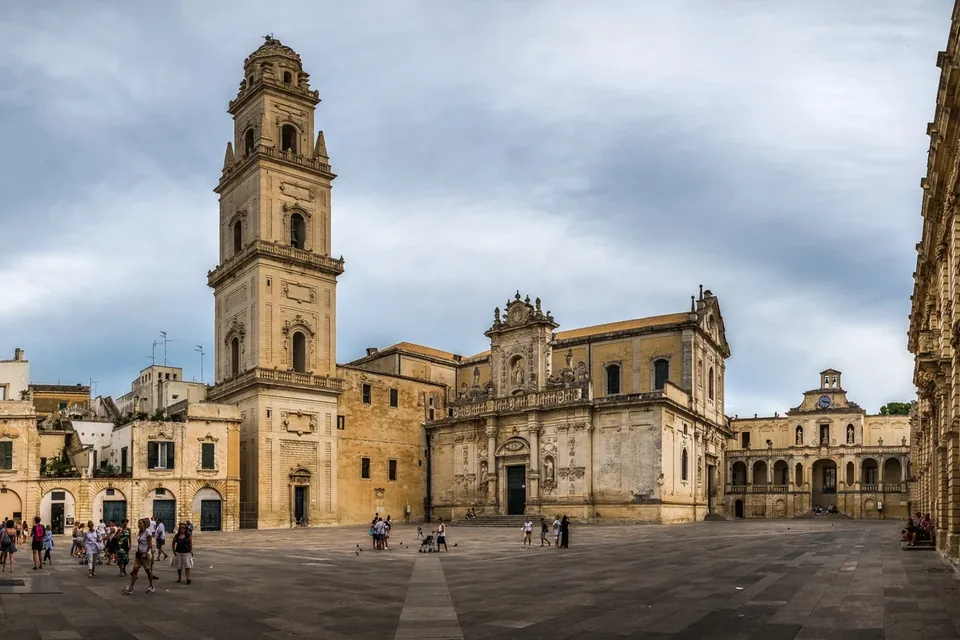
Lecce
Baroque architecture, papier-mâché and Salento food: a city of telling details.
Read the guide →Photo: Giuseppe Milo / Wikimedia Commons — CC BY 3.0 · Resized and converted to WebP.
.jpeg)
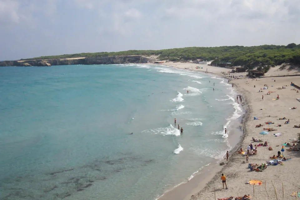
Torre dell’Orso
Sea stacks, pine woodland and a contrast with Melendugno’s inland villages.
Read the guide →Photo: Freddyballo / Wikimedia Commons — CC BY-SA 3.0 · Resized and converted to WebP.

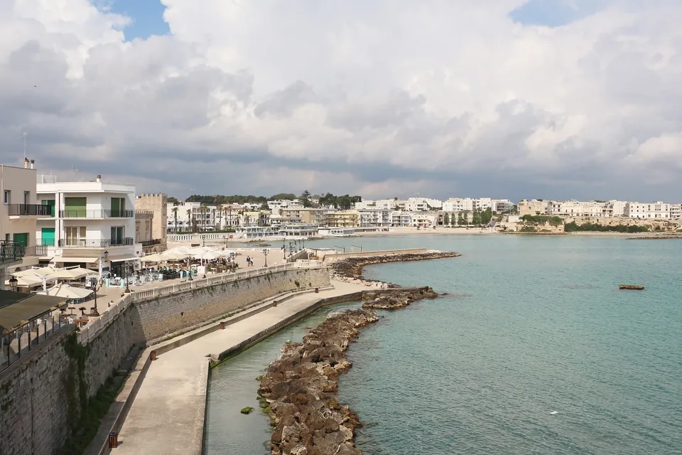
Otranto
The cathedral, Adriatic landscape and time to explore the historic centre.
Read the guide →Photo: Bernard Gagnon / Wikimedia Commons — CC0 · Resized and converted to WebP.

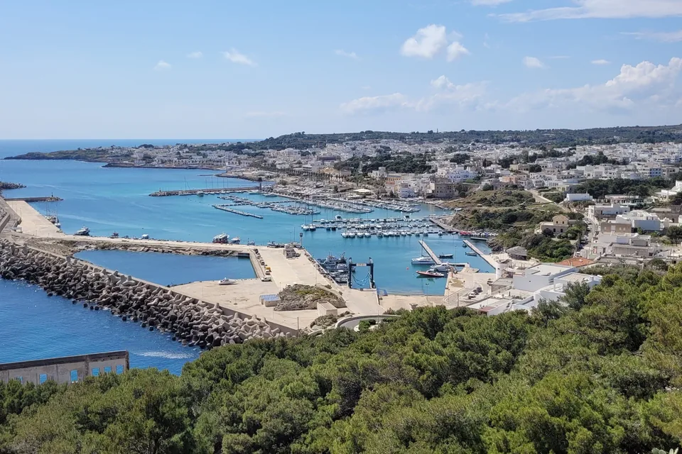
Santa Maria di Leuca
The sanctuary, seafront architecture and the outline of the coast.
Read the guide →Photo: Bernard Gagnon / Wikimedia Commons — CC0 · Resized and converted to WebP.

Places of faith on the route
Basilica Sanctuary of Santa Maria de Finibus Terrae
Basilica · Santa Maria di Leuca (Castrignano del Capo) · Madonna de Finibus Terrae, San Pietro
To taste along the way
Fruttone
PAT · Fresh pasta, bread and pastry
Open the product page →Pasticciotto
PAT · Fresh pasta, bread and pastry
Open the product page →Rustico leccese (Lecce puff pastry)
PAT · Fresh pasta, bread and pastry
Open the product page →Terra d'Otranto extra virgin olive oil
PDO · Oils and fats
Open the product page →Sources
- Cammino del Salento - sito ufficiale (home)
- Cammino del Salento - Le due vie
- Cammino del Salento - Via del Mare
- Cammino del Salento - Segnaletica
- Cammino del Salento - Passaporto del Pellegrino
- Cammino del Salento - Testimonium / Attestato finale
- Cammino del Salento - Come arrivare a Lecce
- Cammino del Salento - Avviso ai camminatori (Via dei Borghi)
- Via dei Borghi del Cammino del Salento - italia.it (Ministero del Turismo)
- Cammini religiosi in Italia - italia.it (Ministero del Turismo)