APULICA / WALKS
The Way of Peace
L'Aquila, Basilica of Santa Maria di Collemaggio → Monte Sant'Angelo, Church of St Michael the Archangel · The official site gives 543 km on foot in its summary figures, but its descriptive text speaks of more than 520 km, and the waymarking page of 520 marked km. The cycling version measures 440 km. · The official site gives 37 stages in its summary figures and 35 stages in its descriptive text. The stage list numbers 29 main stages (13 and 14 are merged) plus eight variants marked "bis"; the guidebook describes 29 stages plus 3 stages of a mountain variant. By bike there are 9 stages.
Key facts
| Start and finish | L'Aquila, Basilica of Santa Maria di Collemaggio → Monte Sant'Angelo, Church of St Michael the Archangel |
|---|---|
| Length | The official site gives 543 km on foot in its summary figures, but its descriptive text speaks of more than 520 km, and the waymarking page of 520 marked km. The cycling version measures 440 km. (Il Cammino della Pace - sito ufficiale (Associazione Il Cammino della Pace APS) · Il Cammino della Pace a piedi - consigli utili e tappe 1-5 bis · Il Cammino della Pace - La segnaletica · Il Cammino della Pace in bicicletta) |
| Stages | The official site gives 37 stages in its summary figures and 35 stages in its descriptive text. The stage list numbers 29 main stages (13 and 14 are merged) plus eight variants marked "bis"; the guidebook describes 29 stages plus 3 stages of a mountain variant. By bike there are 9 stages. (Il Cammino della Pace - sito ufficiale (Associazione Il Cammino della Pace APS) · Il Cammino della Pace a piedi - consigli utili e tappe 1-5 bis · Il Cammino della Pace a piedi - elenco tappe, pagina 2 (tappe 6-9 bis) · Il Cammino della Pace a piedi - elenco tappe, pagina 3 (tappe 10-12) · Il Cammino della Pace a piedi - elenco tappe, pagina 4 (tappe 13-17) · Il Cammino della Pace a piedi - elenco tappe, pagina 5 (tappe 18-23) · Il Cammino della Pace a piedi - elenco tappe, pagina 6 (tappe 24-28) · Il Cammino della Pace a piedi - elenco tappe, pagina 7 (tappa 29) · Il Cammino della Pace - Guida del pellegrino · Il Cammino della Pace in bicicletta) |
| Credential | The association Il Cammino della Pace APS issues a credential to those who intend to walk the route: it identifies the pilgrim, gives access to affiliated accommodation and allows the Testimonium to be obtained at the end. It is requested through the website, together with the membership card. (Il Cammino della Pace - Credenziale e tessera) |
| Regions | Abruzzo, Molise, Puglia |
| Official website | ilcamminodellapace.it |
Map, stages and elevation
Stages mapped on OpenStreetMap: 26 mapped stages, 392 km, 8754 m of ascent and 8766 m of descent computed on the terrain model. Official distances may differ: the figures published by the route prevail.
| Stage | From – to | km | Ascent | Descent | Max altitude |
|---|---|---|---|---|---|
| 4 | Caporciano – Navelli | 10.2 | 70 m | 201 m | 814 m |
| 5 | Navelli – Bussi sul Tirino | 20.4 | 172 m | 521 m | 684 m |
| 6 | Navelli – San Clemente a Casauria | 18.0 | 531 m | 674 m | 785 m |
| 7 | San Clemente a Casauria – Salle | 16.8 | 612 m | 341 m | 523 m |
| 8 | Salle – Caramanico Terme | 10.3 | 342 m | 190 m | 621 m |
| 9 | Caramanico Terme – Roccamorice | 14.0 | 391 m | 485 m | 815 m |
| 10 | Roccamorice – Serramonacesca | 17.3 | 579 m | 802 m | 896 m |
| 11 | Serramonacesca – Roccamontepiano | 9.4 | 364 m | 196 m | 634 m |
| 12 | Roccamontepiano – Guardiagrele | 17.9 | 575 m | 463 m | 578 m |
| 13 | Guardiagrele – Orsogna | 14.2 | 265 m | 411 m | 579 m |
| 14 | Orsogna – Lanciano | 11.5 | 306 m | 463 m | 432 m |
| 15 | Lanciano – Abbazia San Giovanni in Venere | 15.9 | 121 m | 288 m | 285 m |
| 16 | Abbazia San Giovanni in Venere – Trabocco Le Morge | 13.2 | 135 m | 221 m | 125 m |
| 17 | Trabocco Le Morge – Casalbordino | 13.9 | 229 m | 33 m | 205 m |
| 18 | Casalbordino – Monteodorisio | 15.0 | 387 m | 277 m | 315 m |
| 19 | Monteodorisio – Lentella | 15.0 | 483 m | 420 m | 378 m |
| 20 | Lentella – Montenero di Bisaccia | 12.9 | 275 m | 381 m | 382 m |
| 21 | Montenero di Bisaccia – Guglionesi | 16.1 | 429 m | 326 m | 378 m |
| 22 | Guglionesi – Madonna Grande | 18.8 | 205 m | 501 m | 378 m |
| 23 | Nuova Cliternia – Serracapriola | 19.1 | 371 m | 183 m | 270 m |
| 24 | Serracapriola – San Paolo di Civitate | 15.8 | 227 m | 308 m | 270 m |
| 25 | San Paolo di Civitate – Apricena | 13.6 | 38 m | 137 m | 191 m |
| 26 | San Severo – Santa Maria di Stignano | 17.9 | 265 m | 90 m | 294 m |
| 27 | Santa Maria di Stignano – Convento di San Matteo | 11.9 | 603 m | 180 m | 878 m |
| 28 | Convento di San Matteo Apostolo – San Giovanni Rotondo | 10.3 | 285 m | 417 m | 939 m |
| 29 | San Giovanni Rotondo – Monte Sant’Angelo, basilica ipogea di San Michele Arcangelo | 22.5 | 494 m | 257 m | 858 m |
Route: © OpenStreetMap contributors (ODbL) · Elevation: EU-DEM v1.1, Copernicus · Outlines: ISTAT · updated 2026-10-11
In brief
- It presents itself as the first intercultural and interfaith route, from L'Aquila to the Gargano across Abruzzo, Molise and Puglia. (Il Cammino della Pace - sito ufficiale (Associazione Il Cammino della Pace APS))
- As far as possible it traces the transhumance routes and historic roads, walking on footpaths, unpaved roads and cart tracks. (Il Cammino della Pace a piedi - consigli utili e tappe 1-5 bis)
- It is included in the Ministry of Tourism's catalogue of religious walks on italia.it, under Abruzzo, Molise and Puglia. (Cammini religiosi in Italia - catalogo del Ministero del Turismo (italia.it) · Ministero del Turismo, rassegna stampa 12-2024: "Alla ricerca di fede e sostenibilità")
- There is a 440 km cycling version in 9 stages, each between 35 and 60 km. (Il Cammino della Pace in bicicletta)
Why walk it
The Way of Peace links three regions in a single journey on foot: from the valleys around L'Aquila to the slopes of the Maiella, then towards the Adriatic and finally onto the Gargano, ending at Monte Sant'Angelo and its sanctuary of the Archangel Michael. Along the way it crosses villages, pastoral landscapes and places of spirituality, following the routes of shepherds and transhumance.
It is conceived as a route of dialogue, open to anyone whatever their faith, and the association's site describes walking as an inner journey, slow and gradual, made of discovery and reflection. The association presents it as a form of green, quiet tourism that respects the landscape and the traces people have left over the centuries.
Encounter is part of the experience: the stage towns take part in the project so that whoever arrives on foot is received as a friend, not as an outsider. Those looking for wilder nature will find, on the Maiella variants, tiring but deeply rewarding paths where wild animals and grazing flocks may be met.
Sources: Il Cammino della Pace - sito ufficiale (Associazione Il Cammino della Pace APS) · Il Cammino della Pace a piedi - consigli utili e tappe 1-5 bis · Il Cammino della Pace - Come nasce · Il Cammino della Pace - Chi siamo
A route of dialogue across three regions
The Way of Peace is a long walking route across Abruzzo, Molise and Puglia that its promoting association presents as the world's first route devoted to dialogue between cultures and faiths. It starts from the Basilica of Santa Maria di Collemaggio in L'Aquila and, tracing the steps of shepherds along the drove road, reaches Monte Sant'Angelo on the Gargano, with its Church of St Michael the Archangel, passing through five provinces and dozens of towns.
The association that looks after it explains the name this way: peace does not fall from above but grows from the effort of people willing to trust and to act justly, so the route is open to people of every faith; and because peace fosters the human creativity seen in landscapes and art, the route is also intercultural.
The way passes villages, pastoral landscapes and places of spirituality, with local communities offering hospitality. The Ministry of Tourism includes it in its catalogue of religious walks, under each of the three regions it crosses.
Sources: Il Cammino della Pace - sito ufficiale (Associazione Il Cammino della Pace APS) · Il Cammino della Pace a piedi - consigli utili e tappe 1-5 bis · Il Cammino della Pace - Come nasce · Cammini religiosi in Italia - catalogo del Ministero del Turismo (italia.it) · Ministero del Turismo, rassegna stampa 12-2024: "Alla ricerca di fede e sostenibilità"
The stages
According to the official site's list, the main line runs as follows: L'Aquila - Villa Sant'Angelo (19 km), Prata d'Ansidonia (14 km), Caporciano (12.2 km), Navelli (10.2 km), Bussi sul Tirino via Capestrano (20.3 km), San Clemente a Casauria (16.2 km), Salle (16 km), Caramanico Terme (10.5 km), Roccamorice (14.4 km), Serramonacesca (17.2 km), Roccamontepiano (10 km) and Guardiagrele (18.6 km).
From Guardiagrele it reaches Lanciano via Castel Frentano (stages 13-14, 21.8 km), then San Giovanni in Venere (13.4 km), the Le Morge trabocco (13.1 km), Casalbordino (13.6 km), Monteodorisio (15 km), Lentella (15 km), Montenero di Bisaccia (13 km), Guglionesi (16 km), Madonna Grande (18.1 km), Serracapriola (19.1 km), San Paolo di Civitate (15 km), Apricena (20.6 km), Santa Maria di Stignano (18.7 km), San Matteo (11.8 km), San Giovanni Rotondo (10 km) and finally Monte Sant'Angelo (22.4 km).
The "bis" variants include Navelli - Collepietro - Bussi sul Tirino; a high section on the Maiella from Caramanico Terme to Santo Spirito a Maiella, the Di Marco refuge and Guardiagrele; Guardiagrele - Orsogna - Castel Frentano - Lanciano; and a route through San Severo instead of Apricena.
Sources: Il Cammino della Pace a piedi - consigli utili e tappe 1-5 bis · Il Cammino della Pace a piedi - elenco tappe, pagina 2 (tappe 6-9 bis) · Il Cammino della Pace a piedi - elenco tappe, pagina 3 (tappe 10-12) · Il Cammino della Pace a piedi - elenco tappe, pagina 4 (tappe 13-17) · Il Cammino della Pace a piedi - elenco tappe, pagina 5 (tappe 18-23) · Il Cammino della Pace a piedi - elenco tappe, pagina 6 (tappe 24-28) · Il Cammino della Pace a piedi - elenco tappe, pagina 7 (tappa 29)
Terrain, waymarking and difficulty
The official site describes the route as free of particular risks and suitable for everyone; in the list most main stages are rated easy, medium-easy or medium, while some variants, such as Navelli - Collepietro and the climb from Santo Spirito to the Di Marco refuge, are rated demanding. Where it was not possible to stay on drove roads, paths and dirt tracks, the route uses asphalt roads, only rarely busy ones; wild animals may be met anywhere along the way.
Variant stages 9, 10 and 11 cross one of the wildest areas of the Maiella park, on tiring paths exposed to changes in the weather; variant stage 11 has a couple of short exposed passages without protection that call for caution, and the same care is needed on the way up to the rock hermitage of San Giovanni in the Orfento valley.
The route is marked with the horizontal white and red stripe and with stickers showing the two pilgrims of the logo, whose direction shows the way; inside the Majella National Park the signs are panels supplied by the park authority. Marks are not found at every junction and are maintained by the association's volunteers, who often have to replace stickers and plates that have been removed or damaged.
Sources: Il Cammino della Pace a piedi - consigli utili e tappe 1-5 bis · Il Cammino della Pace a piedi - elenco tappe, pagina 2 (tappe 6-9 bis) · Il Cammino della Pace a piedi - elenco tappe, pagina 3 (tappe 10-12) · Il Cammino della Pace - La segnaletica · Il Cammino della Pace - Guida del pellegrino
Credential and tools for the pilgrim
The credential is issued by the association Il Cammino della Pace APS to those who intend to walk the route and undertake to respect the cultural, natural and anthropological heritage they meet. It recognises and identifies the pilgrim, checked against an identity document, gives access to affiliated places offering lodging and meals and, at the end, entitles the holder to the Testimonium. To obtain it you give your personal details, document number and the place where you plan to start; the request is made through the website, together with the membership card.
As for hospitality, the stage towns take part in the project and point walkers to places to eat, to sleep and to have the credential stamped. The accommodation list on the official site includes several types, among them room rentals, agriturismi (farm stays), hotels and a campsite. The site also offers an app with the walking and cycling routes and places to stay, and a pocket guidebook describing each stage with practical advice for those setting out.
Sources: Il Cammino della Pace - sito ufficiale (Associazione Il Cammino della Pace APS) · Il Cammino della Pace - Credenziale e tessera · Il Cammino della Pace - Guida del pellegrino · Il Cammino della Pace - Chi siamo · Il Cammino della Pace - Alloggi
From the L'Aquila earthquake to an association
According to the association's account, the idea of a route from L'Aquila to Monte Sant'Angelo came to Luciano Caramanico during the April 2009 earthquake: his daughter, a student in L'Aquila, survived the night of the quake and in the following days wished to visit San Giovanni Rotondo with the family. In 2010 the L'Aquila - Guardiagrele section was walked as a preview, the result of a twinning between the CAI sections of the two towns.
The route was identified through fieldwork on the ground, with attention to the history and culture of the places crossed. In July 2018 the association Il Cammino della Pace APS was formally founded and its logo and route were registered; the Maiella National Park is among the bodies that have joined.
The official guidebook devotes a part to the historical themes the route passes through: transhumance and drove roads, hermits and monasticism, sanctuaries and places of worship.
Sources: Il Cammino della Pace - Come nasce · Il Cammino della Pace - Guida del pellegrino
Places along the route
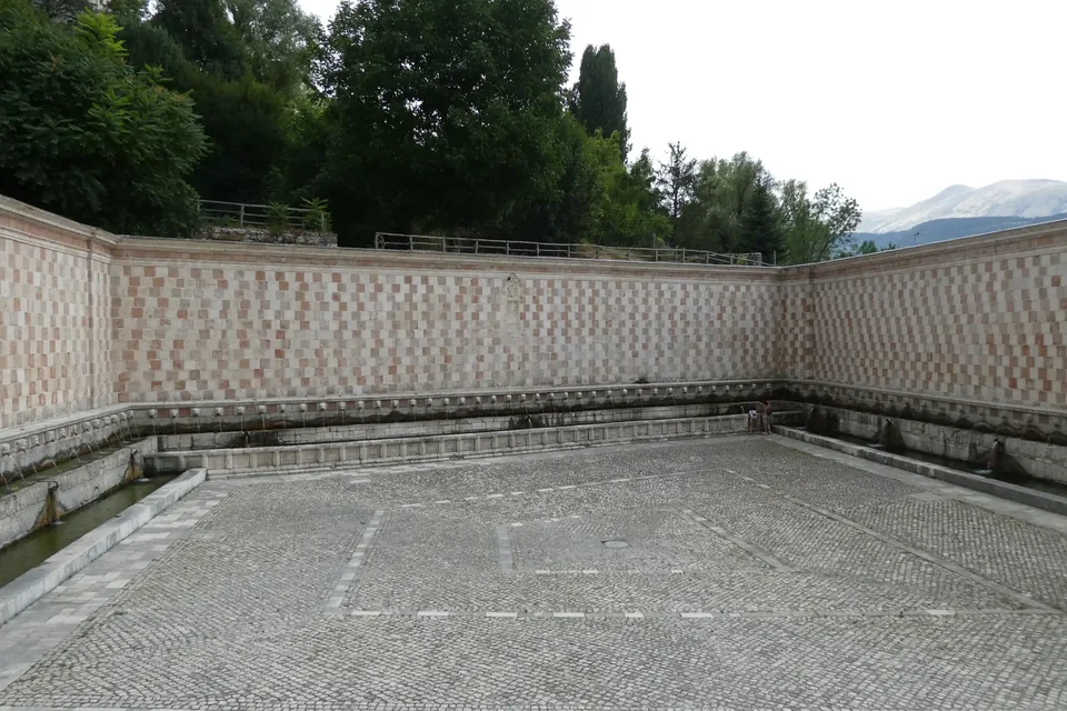
L’Aquila
A capital between the Gran Sasso and the Monti della Laga, with the UNESCO-listed Celestinian Forgiveness and reconstruction still under way.
Read the guide →Photo: Syrio / Wikimedia Commons — CC BY-SA 4.0 · Resized and converted to WebP.

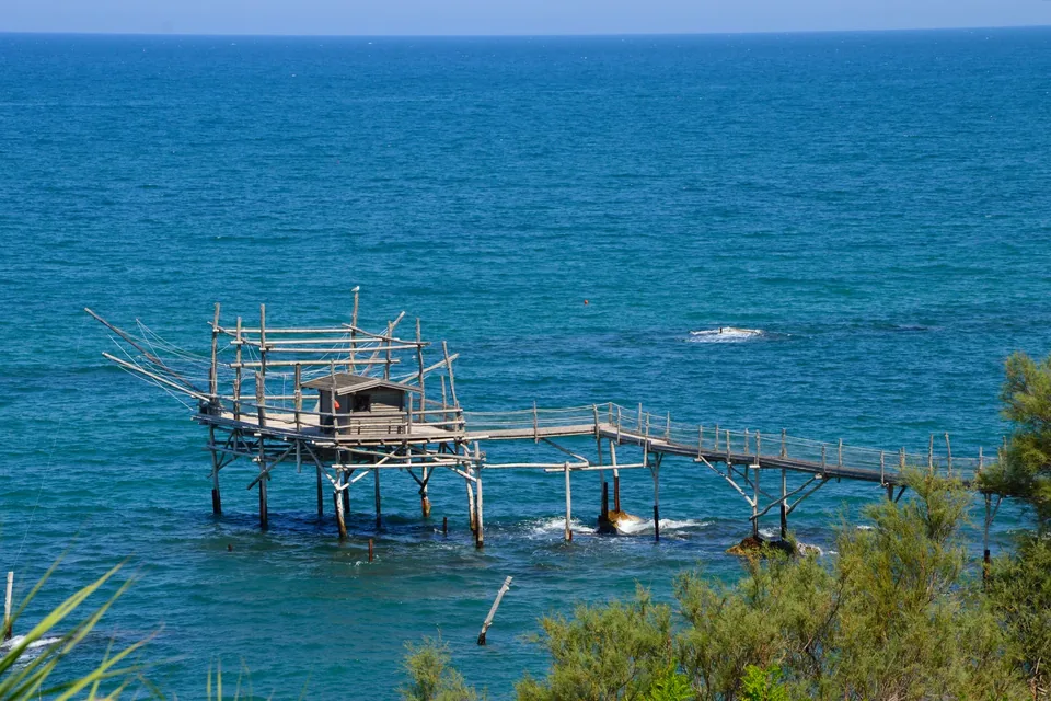
Trabocchi Coast
The Chieti coastline between Ortona and Vasto, with some thirty wooden trabocchi and the hermitage where D’Annunzio stayed.
Read the guide →Photo: Francesca Piersanti / Wikimedia Commons — CC BY-SA 4.0 · Resized and converted to WebP.

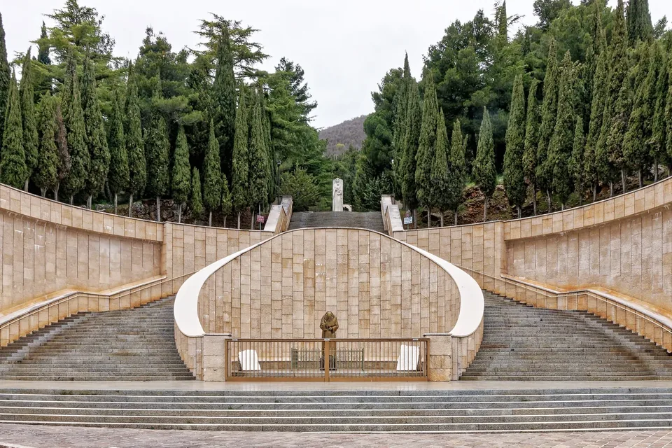
San Giovanni Rotondo
San Giovanni Rotondo: pilgrimage and town.
Read the guide →Photo: Holger Uwe Schmitt / Wikimedia Commons — CC BY-SA 4.0 · Resized and converted to WebP.

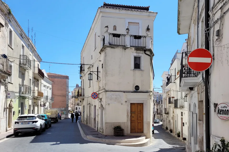
Monte Sant’Angelo
Monte Sant’Angelo: the cave and Junno quarter.
Read the guide →Photo: Bernard Gagnon / Wikimedia Commons — CC0 · Resized and converted to WebP.

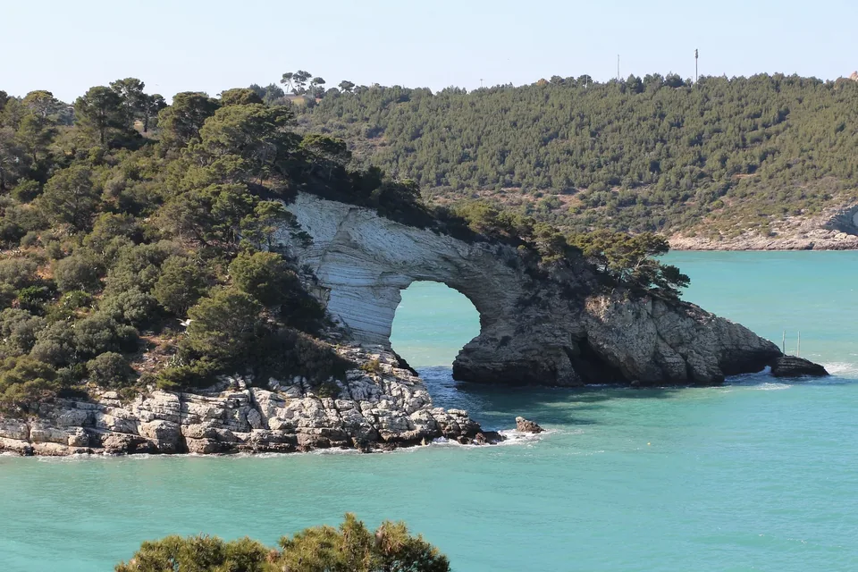
Gargano
Gargano: villages, woodland and coast.
Read the guide →Photo: Bernard Gagnon / Wikimedia Commons — CC0 · Resized and converted to WebP.

Places of faith on the route
Sanctuary of Saint Pio of Pietrelcina
Sanctuary · San Giovanni Rotondo · Padre Pio
Sanctuary of Saint Michael the Archangel
Cave sanctuary · Monte Sant'Angelo · San Michele Arcangelo, San Lorenzo Maiorano
Basilica of Santa Maria di Collemaggio
Basilica · L'Aquila · San Pietro Celestino (Celestino V), Madonna Assunta
Shrine of the Eucharistic Miracle (Church of San Francesco)
Sanctuary · Lanciano (Chieti) · Miracolo Eucaristico, Frati Minori Conventuali
To taste along the way
Gargano orange
PGI · Slow Food Presidium · Fruit, vegetables and pulses
Open the product page →Caciocavallo podolico of the Gargano
Slow Food Presidium · Cheeses
Open the product page →Garganica goat
Slow Food Presidium · Meats and cured meats
Open the product page →Bagno onion
Slow Food Presidium · Fruit, vegetables and pulses
Open the product page →Dauno extra virgin olive oil
PDO · Oils and fats
Open the product page →Paganica beans
Slow Food Presidium · Fruit, vegetables and pulses
Open the product page →Carpino broad bean
PAT · Slow Food Presidium · Fruit, vegetables and pulses
Open the product page →Gargano Femminello lemon
PGI · Slow Food Presidium · Fruit, vegetables and pulses
Open the product page →Ostie ripiene (filled wafers of Monte Sant'Angelo)
PAT · Fresh pasta, bread and pastry
Open the product page →Pane di Monte Sant'Angelo (Gargano bread)
PAT · Fresh pasta, bread and pastry
Open the product page →Podolica cow of the Gargano
Slow Food Presidium · Meats and cured meats
Open the product page →Zafferano dell'Aquila saffron
PDO · Fruit, vegetables and pulses
Open the product page →Sources
- Il Cammino della Pace - sito ufficiale (Associazione Il Cammino della Pace APS)
- Il Cammino della Pace a piedi - consigli utili e tappe 1-5 bis
- Il Cammino della Pace a piedi - elenco tappe, pagina 2 (tappe 6-9 bis)
- Il Cammino della Pace a piedi - elenco tappe, pagina 3 (tappe 10-12)
- Il Cammino della Pace a piedi - elenco tappe, pagina 4 (tappe 13-17)
- Il Cammino della Pace a piedi - elenco tappe, pagina 5 (tappe 18-23)
- Il Cammino della Pace a piedi - elenco tappe, pagina 6 (tappe 24-28)
- Il Cammino della Pace a piedi - elenco tappe, pagina 7 (tappa 29)
- Il Cammino della Pace - Come nasce
- Il Cammino della Pace - Credenziale e tessera
- Il Cammino della Pace - La segnaletica
- Il Cammino della Pace - Guida del pellegrino
- Il Cammino della Pace in bicicletta
- Cammini religiosi in Italia - catalogo del Ministero del Turismo (italia.it)
- Ministero del Turismo, rassegna stampa 12-2024: "Alla ricerca di fede e sostenibilità"
- Il Cammino della Pace - Chi siamo
- Il Cammino della Pace - Alloggi