Why go
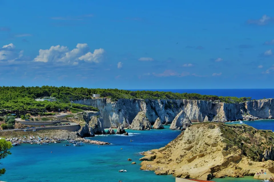
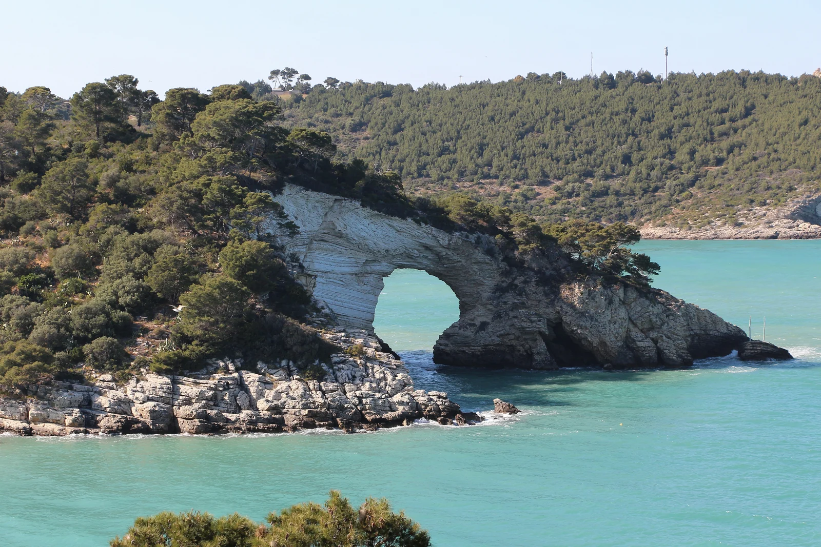
Gargano is the spur of Puglia: a mountainous promontory that rises from the Tavoliere plain and drops towards the Adriatic, which surrounds it on three sides. Within a fairly compact area it brings together upland beech woods, pastures, terraced olive groves, coastal lagoons, limestone cliffs and white towns overlooking the sea. The whole area is protected by the Gargano National Park, which also includes the Lesina and Varano lagoons and the marine reserve of the Tremiti Islands.
The Region's landscape plan describes the promontory as a compact limestone mountain with a recognisable stepped profile and a wide inner plateau between 600 and 1,000 metres, dominated by woods and pastures, while the towns lie mostly around its edges. This contrast between a sparsely inhabited interior and a ring of towns on the coast and slopes is what gives Gargano its variety.
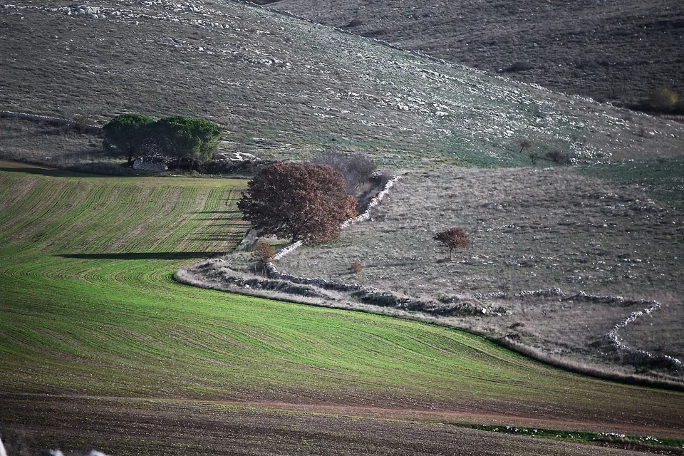
In its presentation map the Park stresses another side: Gargano is also the mountain of the Archangel Michael, a land of very old cults and a landscape shaped by centuries of work, with dry-stone walls, terraces and olive groves. Visitors therefore find several possible journeys in the same territory: the sea, the forest, the sanctuaries and everyday life in the towns.
Sources: Gargano — fonte istituzionale · Regione Puglia — Piano paesaggistico, Gargano · Parco nazionale del Gargano — paesaggio e sentieri
History
Gargano's history begins with geology. According to the regional landscape plan, the promontory still keeps in its shape the identity of an ancient island, separated from the rest of Puglia before the Tavoliere plain emerged; even today it is bounded by the Candelaro stream, the sea and the waters of its coastal lagoons.
Human presence is very old. The Park mentions the Defensola flint mine and the Paglicci site among the most remote traces, together with the wetlands of Manfredonia. Over time the promontory also became a sacred place: a wood celebrated by Latin poets, a seat of pagan cults and then the mountain of the Archangel Michael, a pilgrimage goal along the sacred route climbing to Monte Sant'Angelo.
Other chapters are written in the landscape. The Varano lagoon, which old maps and the silence of historians suggest is relatively recent, is thought to have formed around the year 1000. Citrus fruit, according to the Park, is documented from 1003, when Melo, prince of Bari, sent the Gargano's “pomi citrini” to Normandy to show the wealth of these lands. Coastal towers, fortifications, terraces and stone huts complete the story of a territory that has been lived in and worked without interruption.
Sources: Parco nazionale del Gargano — paesaggio e sentieri · Regione Puglia — Piano paesaggistico, Gargano · Parco Nazionale del Gargano — Laguna di Varano · Parco Nazionale del Gargano — Agrumeti
What to see
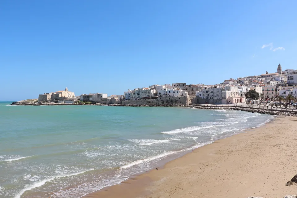
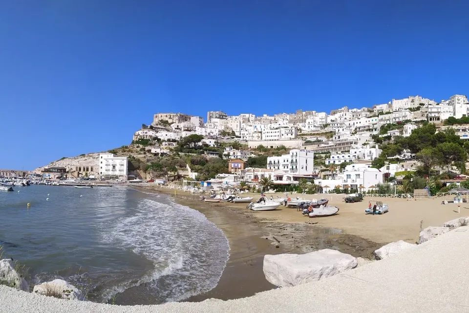
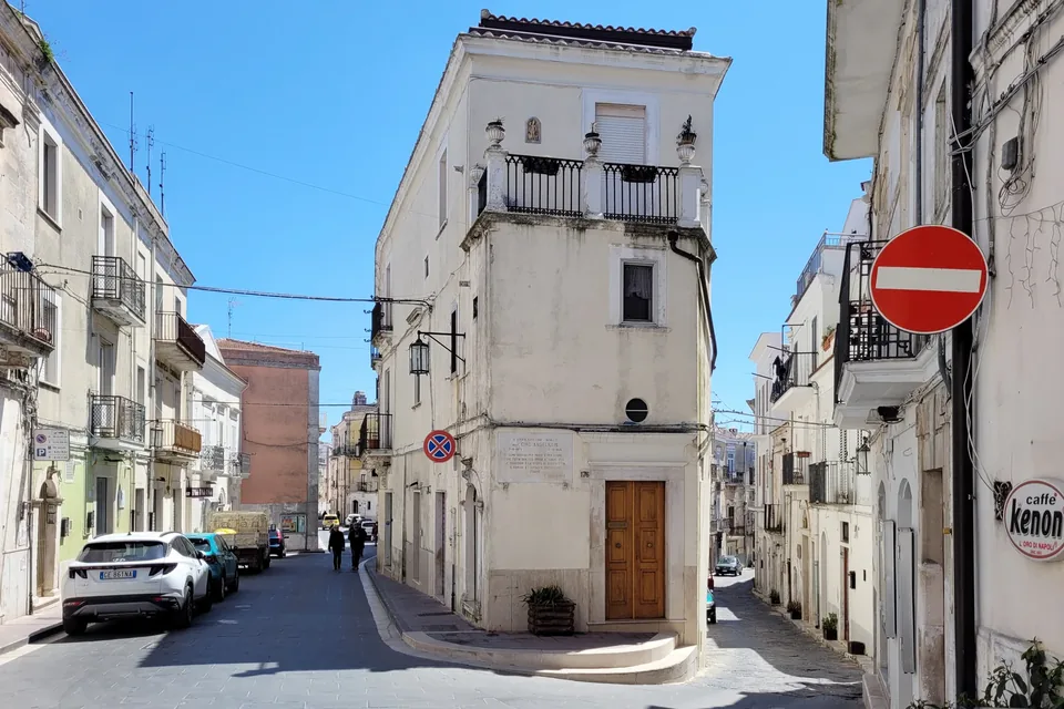
On the coast, the national tourism portal points to Vieste with its lighthouse, its old town overlooking the sea and Pizzomunno beach, dominated by a 26-metre limestone monolith; a little further west, Peschici and Rodi Garganico complete the line of coastal villages. Inland and on the slopes stand Vico del Gargano, Monte Sant'Angelo with the Archangel's sanctuary, and San Giovanni Rotondo, linked to the figure of Padre Pio.
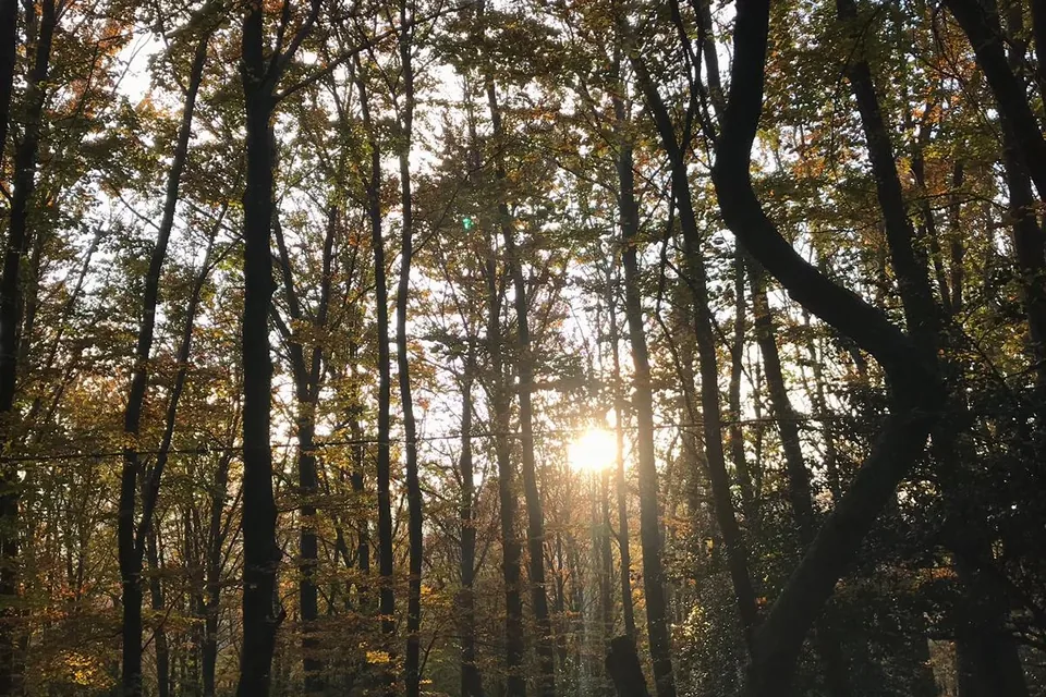
The Foresta Umbra spreads across the heart of the promontory: according to the Park, over 12,000 hectares of almost continuous woodland, with nature reserves where beech grows at unusually low altitudes alongside hornbeams, maples, yews and Mediterranean species. The Ministry's portal notes that it has been a UNESCO natural heritage site since 2017 and that its trails, the Laghetto d'Umbra and picnic areas make it accessible to families too.
To the north, the Lesina and Varano lagoons show a Gargano of water. Varano, at about 6,500 hectares, is the largest lagoon in southern Italy and is separated from the sea by a long strip of dunes and pine woods known as the Isola. In Lesina, the lagoon park's Visitor Centre presents the nature and traditions of the lagoon and organises excursions, including boat trips.
Sources: Gargano — fonte istituzionale · Parco Nazionale del Gargano — Laguna di Varano · Parco Nazionale del Gargano — Foresta Umbra · Italia.it (Ministero del Turismo) — Foresta Umbra · Centro Visite Lesina — laguna, musei e tradizioni
Food and wine
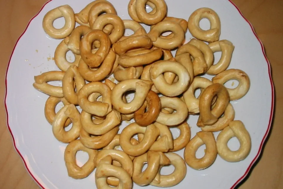
Gargano's cooking follows its landscapes. The national tourism portal mentions bruschetta with melted caciocavallo, handmade orecchiette with tomato sauce, tagliolini with scampi and sweets made with fruit and almonds. On the hills, olive trees cover about 20,000 hectares: the main variety is Ogliarola garganica, alongside Peranzana and Rotondella, and the extra virgin oil falls under the Dauno PDO with the geographical mention Gargano.
Between Rodi Garganico, Vico del Gargano and Ischitella grow the citrus fruits that the Park helped revive with its Citrus Oasis: today Arancia del Gargano and Limone Femminello del Gargano are PGI products, and the Park also points to the sweet-fruited bitter orange, an old citrus with a sweet-and-sour taste. The fruit can be bought directly from growers. In Vico, every February, the procession of Saint Valentine blesses the trees and fruit of the citrus groves.
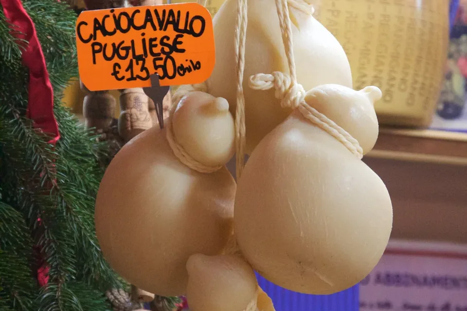
From the interior come the Fava di Carpino, a Slow Food presidium bean grown in rotation with durum wheat, tomatoes and lupins, and the Caciocavallo podolico del Gargano, made from the scarce milk of grazing Podolica cows and sold almost only locally. The Lesina and Varano lagoons provide brackish-water fish such as grey mullet and eels.
Sources: Gargano — fonte istituzionale · Parco Nazionale del Gargano — Olio extravergine di oliva · Parco Nazionale del Gargano — Agrumi dell'Oasi agrumaria · Parco Nazionale del Gargano — Agrumeti · Parco Nazionale del Gargano — Fava di Carpino · Fondazione Slow Food — Presidio Caciocavallo podolico del Gargano · Parco Nazionale del Gargano — Laguna di Varano
Things to do
Gargano lends itself to exploration on foot, by bike and on horseback. The Grande Traversata Garganica, created between 2007 and 2009, is a loop of about 200 kilometres waymarked in red and white that links coast and interior: it passes through San Giovanni Rotondo, the Foresta Umbra, Vico del Gargano, Carpino and Cagnano Varano along old roads, drove tracks and mule paths. It can be walked in full or in stages.
The Park's map suggests other themes to follow: dinosaur footprints and geological origins, birdlife in the wetlands, the karst landscape and coastal habitats, the Citrus Oasis, the coastal towers and the sacred route linked to the cult of Saint Michael. In the Foresta Umbra many trails of varying difficulty and the picnic areas allow even short outings, and the Ministry of Tourism points to the woodland playground and the fallow deer reserve for children.
On the northern side, the Lesina Visitor Centre offers nature excursions and boat trips on the lagoon, including at sunset. Finally, in summer, boats leave the coast for the Tremiti Islands, the Park's marine reserve: from Vieste, Rodi Garganico, Peschici and Capoiale between June and September.
Sources: Parco Nazionale del Gargano — La Grande Traversata Garganica · Parco nazionale del Gargano — paesaggio e sentieri · Italia.it (Ministero del Turismo) — Foresta Umbra · Centro Visite Lesina — laguna, musei e tradizioni · Area marina protetta Isole Tremiti — Come arrivare
When to go
Gargano is at its best between spring and autumn, with a different character in each season. In spring and autumn temperatures suit long walks, such as sections of the Grande Traversata Garganica, and the woods are at their most varied: the Ministry of Tourism notes that in autumn the Foresta Umbra turns to foliage colours.
Summer is the season of the sea and the islands. From June to September the ports of Vieste, Rodi Garganico, Peschici and Capoiale join Termoli in serving the Tremiti Islands, and in the hot months the shade of the beech trees and the banks of the Laghetto d'Umbra offer a cool alternative to the coast. Those who want both sea and interior can alternate beach days with forest walks.
The promontory has its occasions out of season too: in February, in Vico del Gargano, the procession of Saint Valentine, protector of the citrus groves, blesses orange and lemon trees. For the patronal and religious feasts of the individual towns, it is worth checking each year the programme published by the municipalities.
Sources: Italia.it (Ministero del Turismo) — Foresta Umbra · Area marina protetta Isole Tremiti — Come arrivare · Parco Nazionale del Gargano — La Grande Traversata Garganica · Parco Nazionale del Gargano — Agrumeti
Getting there and around
For those arriving by train, the reference station on the national network is Foggia, as the regional tourism portal points out; from there and from San Severo you continue towards the promontory. Ferrovie del Gargano runs the San Severo–Rodi–Peschici (Calenella) line, about 74 kilometres long and electrified as early as 1931, which serves the towns of the northern coast.
Getting around is mostly by bus or car. Ferrovie del Gargano is part of the regional COTRAP consortium and runs a network of intercity bus lines on the promontory, as well as long-distance links to Rome, Fiumicino airport and several Italian cities. By car, the Poggio Imperiale–Lesina exit of the A14 motorway leads to the northern coast, while the Foggia exit leads to the southern side.
The nearest airports are those run by Aeroporti di Puglia: Bari for scheduled flights and Foggia, from which a year-round helicopter service also links to San Domino in the Tremiti Islands. To reach the archipelago by boat, Termoli is the port operating all year round, while in summer services also leave from the Gargano ports.
Sources: Viaggiare in Puglia (Regione Puglia) — Monte Sant'Angelo · Ferrovie del Gargano — La rete ferroviaria · Ferrovie del Gargano — Autolinee · Area marina protetta Isole Tremiti — Come arrivare · Aeroporti di Puglia — Aeroporto di Foggia
Where to stay
On Gargano the choice of base depends on the trip you have in mind. Coastal towns such as Vieste, Peschici and Rodi Garganico offer hotels, holiday homes and B&Bs in the old towns or by the sea, handy for alternating beaches and evening strolls; in summer they are also the departure points for boats to the Tremiti.
Those who prefer the interior will find accommodation in the hill and upland towns, such as Monte Sant'Angelo, San Giovanni Rotondo and Vico del Gargano, with woods and pastures close at hand. In San Giovanni Rotondo, because of Padre Pio's sanctuary, there is a large network of hospitality for pilgrims. In the Foresta Umbra and the countryside there are places to stay surrounded by greenery and farm stays, suited to those who want to walk and observe nature.
On the northern side, the Lesina and Varano lagoons offer a quieter base linked to fishing and nature. The landscape plan notes that Gargano's towns lie mainly around the edges of the plateau: inland distances look short on the map but the roads are mountain roads, so it is worth choosing one or two bases and organising visits around them.
Sources: Gargano — fonte istituzionale · Regione Puglia — Piano paesaggistico, Gargano · Italia.it (Ministero del Turismo) — Foresta Umbra · Centro Visite Lesina — laguna, musei e tradizioni
Nearby
Gargano is also a starting point. Off the northern coast, the Tremiti Islands, the Park's marine reserve, can be reached by boat from Termoli all year round and from the Gargano ports in summer: San Nicola, with its fortified complex, and San Domino, with its pine woods and coves, deserve at least a full day.
To the south and west the promontory faces the Tavoliere plain, which the landscape plan describes as the great flat counterpart of the Gargano mountain. At the foot of the southern slope lie Manfredonia and its gulf, with the wetlands that the Park lists among its places of natural and archaeological interest, and the Mattinata plain with its olive groves.
On the promontory itself, each town opens a different theme: Vieste and Peschici for the sea and white villages, the Foresta Umbra for nature, Monte Sant'Angelo and San Giovanni Rotondo for places of faith. Linking them calmly, one or two a day, lets you take in the passage from sea to forest and from lagoon to mountain that makes Gargano so varied.
Sources: Gargano — fonte istituzionale · Area marina protetta Isole Tremiti — Come arrivare · Regione Puglia — Piano paesaggistico, Gargano · Parco nazionale del Gargano — paesaggio e sentieri
Where to stay
In the municipality of Monte Sant'Angelo the national database of the Ministry of Tourism lists 97 accommodation businesses with a verified CIN code: 5 hotels, 18 other licensed accommodation and 74 other types such as B&Bs and private rentals.
Licensed businesses from the official list of Regione Puglia, each with a checked national CIN code: matching municipality and category. Private individuals are not listed. Check directly with the property before booking.
Affittacamere Gli Angeli
Guest rooms
CIN IT071033B400069422
CASA NATURA COPPA DEL GIGLIO
Guest rooms
CIN IT071033B400021042
VALLE DEL DOLMEN
Guest rooms
CIN IT071033B400032253
VILLA BISCEGLIA
Guest rooms
CIN IT071033B400024532
VILLA SIMONE
Guest rooms
CIN IT071033B400024015
Villa Grazia
Guest rooms
CIN IT071033B400100630
AGRICAMPING SANTAMARIA
Farm stay
CIN IT071033B500080535
AGRITURISMO CANTONIERA D'UMBRA
Farm stay · Website
CIN IT071033B500032336
BARONE GAMBADORO
B&B
CIN IT071033B400023342
CANTINE CIPPONE ROOM
B&B
CIN IT071033B400119981
MICHAEL
B&B
CIN IT071033B400023306
CASE MALU'
Holiday home
CIN IT071033B400088332
CASA DEL PELLEGRINO
Hotel · ★★★
CIN IT071033A100021121
ELDA HOTEL
Hotel · ★★★★ · Website
CIN IT071033A100032418
HOTEL RELAIS DEI NORMANNI
Hotel · ★★★★
CIN IT071033A100023630
HOTEL SANTANGELO
Hotel · ★★★
CIN IT071033A100108757
PALACE HOTEL SAN MICHELE
Hotel · ★★★★
CIN IT071033A100021130
BAIA DEL MONACO
Holiday village · ★★★★
CIN IT071033B200022184
Sources: Regione Puglia – ARET Pugliapromozione (DMS), CC BY 4.0, 2026-10-12 · Ministero del Turismo – Banca Dati Strutture Ricettive (dashboard pubblica), 2026-10-12
YOUR JOURNEY
How to shape a journey here
We can design a Gargano stay around water landscapes, crafts and cultivated gardens, selecting a base and connecting only stops coherent with your interests.
Talk to us about it